Earlier this month, our joint Univ. of Texas and Univ. of Kansas team returned from West
Greenland, where we collected data regarding the behavior of ocean-terminating glaciers
in a major fjord system.
Many of the sensors we visited,
including GPS receivers, seismometers, weather stations and time lapse cameras, had been
recording data for a year, since we installed them in August 2013. While in the field,
we also had the opportunity to camp at the terminus of Rink Isbrae (71.5 degrees north
latitude) for 10 days. During that time of focused terminus observations, we were able
to scan the terminus with a radar system every 2.5 minutes to detect detailed variations
in the speed at which the glacier was moving. Our team of 5 scientists had a great time
working together and developing a better sense for how these beautiful and rapidly
changing glacier/ocean systems work.
Together, our data will allow us to
better understand the factors that lead to increasing and decreasing glacier stability.
Ultimately, this understanding will allow the glaciological community to make better
projections of future glacier change- the leading contributor to the increased sea level
anticipated this century.
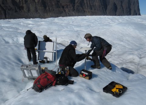
In this photograph, our field team resets a GPS station on the ice. Stations such as
these allow us to identify the response of the glaciers to ice melt, rain, glacier
thinning, and iceberg calving events.